The area is well suited to walking. One popular local walk is the "Three Bridges"; starting at the Wye bridge, along the Groe to the "Swing" bridge over the river Irfon and to Irfon bridge, returning to the town by the reverse route, or along Garth Road, or if you're still feeling fit, you can walk along the Irfon towards Nantyarian, and either walk right into the countryside in the direction of Maesmynis and Llanynis, or left at the end of Irfon Bridge Road and towards Garth Road via Hospital Road passing the hospital and the new primary school. Walk 1
Newry Road is part of the Wye Valley Walk, so the more adventurous can follow the signposted Walk at the top of Sunnybank pitch straight on down the hill to Dolfach, crossing the footbridge, and climbing over the country lanes and hills towards Erwood. Great views over the wye valley and the hills of south Radnor. (Make sure you have a map and compass, and good boots and clothing!)
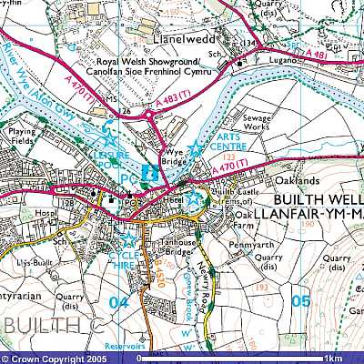
The National Cycle Route also passes Builth, and the section from Jewsons (in Llanelwedd near the Wye bridge) to the new industrial estate is a very pleasant walk, especially early morning, or evening. It follows a section of the old railway line along the banks of the river Wye, and takes you close to St. Matthew's Church at Llanelwedd. Although it is not a long walk, you can often be rewarded with the site of ducks, swans, geese, herons, rabbits, buzzards, and if you're very lucky, the kingfisher, or the red kite. You could, of course, take something to sit on and watch the fishermen, or lie back and relax on the bank. Walk 3
The Royal Welsh Showground hosts several events throughout the year including its own agricultural show in July. Have a look at their website for further information.
The area is fast becoming a centre for mountain biking as well as car rallies.
Nearby Llandrindod Wells, another of the mid-Wales spa towns, has a Victorian Festival, stretching over a week culminating in a firework and torchlight display on the Sunday.
Llanwrtyd Wells, to the west on the A483, has created something of a niche market for some remarkable events - Man v. Horse cross country race, bog snorkelling, as well as food and beer festivals.
Many of the villages have their own shows, with flowers, fruit and veg, agricultural and sometimes, trotting and harness races.
In the Cambrian mountains to the west are two of the reservoir complexes which supply water to large towns in Wales and England, Llyn Brianne which can be accessed via a scenic route, one track with passing places, turning off the A483 at Beulah and turning left in Abergwesyn along the Gwesyn valley and climbing the infamous Devil's Staircase, a steep zig-zag section and then a sharp drop towards the junction for the dam or onto towards Pontrhydfendigaid again over narrow single track road. The Elan Valley reservoirs are near to Rhayader, and the road takes you around the Claerwen, Elan dams, either looping back or taking you on via the old Aberystwyth coach road.