Home | The Town | Castle Intro | Castle | Llywelyn | Links
The town of Builth Wells
Llanfair-ym-muallt - Buallt - Builth Wells
The name Builth is believed to
have come from the corruption of Buallt or Buellt, Welsh for
"ox (bu) on the wooded slope, (allt)"
certainly there are plenty of hills and slopes which in those
early days would almost certainly have been wooded. The present
town crest depicts a brown bull on a hillside. The original
Buallt was the name given to the Cantref (an old administrative
area). This cantref is said to have covered an area between the
rivers Wye and Twyi and north of a line drawn approximately from
Erwood to Llanwrtyd (covering an area of 174 square miles north
of the Eppynt). The Eppynt formed a natural barrier to the south
of the town, and with the Irfon and Wye forming a barrier to the
west and north, it is perhaps not surprising that a castle
(castles?) was built at Builth. The town grew around the castle,
much of it below the escarpment on which the castle was built,
and above the flood level of the river Wye. The first settlements
were scattered over the area, before the eventual formation of
streets and lanes. There is a Norman origin for the Church of St.
Mary, the parish church of Builth. The Welsh name for Builth
after the founding of the church became Llanfair ym Muallt, the
Church of St Mary in the Cantref of Buallt/Builth. In 1690/1 the
town suffered a terrible fire, and funds were raised for the
rebuild, however little money seems to have been used in the
reconstruction! There are stories that the stone, timber and
other materials from the now derelict castle were used to build
houses in Builth following the fire, certainly there is little
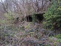
stonework apparent on the existing castle site. The only large
stones to view are at the entrances to the castle stiles in
Castle Road, the greater number near Castle Terrace.
To the west of the town Nantyrarian brook, which feeds into the
river Irfon, is rumoured to have gained its name (translates as
The Money Brook) when the plague ravaged the country in the
1350s, and coins were supposedly thrown into the brook by the
townspeople when purchasing goods from people in the countryside,
the water washing and purifying the coins so preventing the
spread of infection!
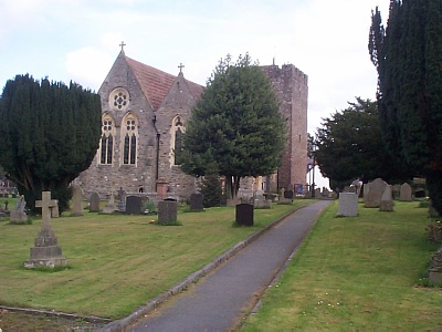
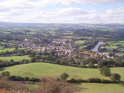
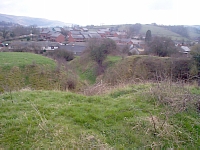
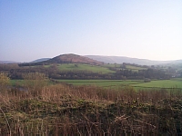
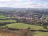
St. Mary's Church, Builth Wells from the west and a view of Builth from Garth Hill
Later the discovery or perhaps commercialization of wells, Chalybeate, saline, and sulphur at The Park Wells, and chalybeate and saline at the Glanne Wells, both on the western edge of the town, brought a new lease of life to Builth as it became one of the famous spa towns of mid-Wales, with great numbers of miners and their families, and those of higher social status, coming to "take the waters". Guest houses and hotels sprung up mainly in the west of the town nearer the spas at the Glanne and Park Wells, either side of the present golf course. This of course led to the suffix of Wells to the original Builth. The Town Council of the time decreed that no pig styes could be built in Garth Road, and deplored the fact that some landladies were taking in working-class visitors, whereas they should be encouraging a higher class of clientele, all this to try and outdo the more established spa of Llandrindod Wells, it never achieved this, and bankruptcy affected both of the Wells. Construction of pavements in Garth Road were the responsibility of the house-owners, with the result that it was quite dangerous, some fronts were pavemented, others were not. One of the oldest properties in Builth is known as Old Pendre, but in earlier times was Ystrad Farm, the Pendre was actually the name of a field which now contains the housing estate of the same name. The Wye was dammed to create an area for boating just below the Aber Pool (where the Irfon merges with the Wye), and a boathouse built. This building, in wood, became known as Jane's Parlour, and was still in existance into the 1960s. If you look close you can see the stones of the old dam in the river. Two large buildings, The Strand Hall, built by squire Bligh of Cilmery, and the Market Hall (now Wyeside arts centre), were erected c.1876. The Strand is used by community groups and by the County Council as offices for the town of Builth. It has hosted hundreds of Saturday night dances, concerts, town meetings, and school concerts. The Market Hall did function for many years as a market, with stalls inside and outside, shops were incorporated into the ground floor level, including the town library for many years and this area was a bustling lively part of the town, with a greengrocers, shoe shop, sweet shop, newsagents, and hairdressers. Upstairs E. Taylor (Cinemas) Ltd, ran the Castle Cinema for many years, part of a groups of cinemas at Rhayader, Llandrindod, Llandovery. The cinema manager, Mr Harry Lewis, ran the business very successfully before the Wyeside arts centre took over the building. The shops have now closed, the library moved into the centre of the town, and there is no longer a market here.
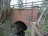
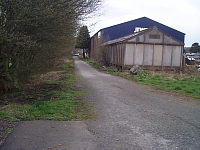
The railway, Brecon to Moat Lane, ran through some of the beautiful countryside of the Wye valley, and came to Builth in 1864, but suffered the fate of so many branch lines under the axe of Mr Beeching in 1962. When the railway was built, the roads at Llanelwedd were re-aligned, both the road to Rhayader and Llandrindod were moved north slightly and a new road from Llanelwedd Arms built northwards to join with the two re-aligned routes. This move made it necessary to have only one level crossing instead of two. According to Morrison the wall supporting the railings of the old station yard alongside the A483 came from Aberedw Castle, part of which was destroyed when the line was pushed through. The old line passed the granite quarries, and a siding was constructed to carry stone from the Gelli Cadwgan (or Manor) Quarry to the new dams at Elan Valley for the Birmingahm Water Corporation. The line also ran alongside the Creamery, (CWS), which has subsequently closed, and after several years as a wholesale grocers, is now a garage.
The association with livestock goes way back, and the town is known as a market town. The current Smithfield was built in 1910, prior to this the sheep were sold on Bank Square, and Market Street. The pens were still visible for many years after outside the Sun Inn. The cattle were sold in the High Street from the Swan Hotel down towards Broad Street. Eventually with the new spa town, this became undesirable, and the idea of a new smithfield was welcomed. The now established railway transported livestock, and pens were built at the railway yard to accommmodate them. Royal mail was carried on the railways at this time, coal was also conveyed by rail for re-distribution, and the weighbridge was located on the edge of the yard near the entrance to Jewsons. The Radnorshire Coal Company (Radco) operated here for a long period. With the long association with cattle, and other livestock passing through the town, it was natural that the town had several tanneries, one of the last was built in south of the town, in the area of Newry Road, though at that time it was known as Tanhouse Terrace. The old works have now been converted into two dwellings, and looking at the structure there are two styles of architecture, so it is presumed that there were two phases in the building.
Water for drinking for the town came from either springs or wells in the town, or from the wells found in Newry Road, and, according to one late resident, the water was piped along the Gloew brook into the town, this obviated the need for digging a trench. Later, a reservoir was constructed on the Eppynt hills, and a water treatment plant built just outside Builth. This coincided with improved sanitation, which was long overdue in Builth.
The east of the town was considered the working class area, and Oaklands was constructed to provide housing not only for the workers of the gas supply works but also for the railway workers. A similar terrace was constructed at nearby Builth Road for their railway workers. The railway provides a mode of transport for many farmworkers, and migration along the line was common. A workhouse was built near Victoria Terrace, just off Brecon Road. The building was called grandly named "Victoria House" and was in existence until 1941 when it was demolished, it was a large site, and most of it is now covered by housing. The town had its own brewery, just down the road from the workhouse, and this structure has now been converted into flats, and the neighbouring Wool stores, where the fleeces of local sheep were taken, closed to become a warehouse and retail outlet for the West Breconshire Farmers Society, later Hay and Brecon Farmers, it was demolished and is now under the road entrance to the new Co-op store. A cottage hospital was constructed in 1897, funded by donations, endowments and subscription. It has had strong local support ever since, and numerous threats to close it have, so far, been successfully defeated. A fire service started probably in the early 1890s, but for some odd reason, probably financial, it appears it was disbanded, to cost the town dear when a fire broke out, and neighbouring brigades arrived too late to save considerable damage. In 1910 a fire engine was purchased, hauled by a steam lorry (though one fireman from the AFS told me it was hauled by horses kept in a field at the old brewery), and this was in use until 1941! Pictures show the engine outside the old fire station in Smithfield Road.
The present town has a population of 2352 (census 2001), and has spread to the west and south of the original town. Housing estates now cover the hillsides of the Wye valley to the south, forming a visible arc around the old town.
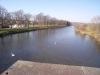
Bridges cross the rivers Wye and Irfon, carrying the A470 and A483. The Wye bridge, often referred to as Builth bridge, was built in 1779, a beautiful 6-arched structure. Unfortunately, it didn't have high parapets, and the bridge was narrow, probably only wide enough for a cart in one direction, the parapet was raised, but it wasn't until 1925 that it was widened. In more recent times strengthening and repair work has been undertaken, and it is probably the most photographed part of Builth. A three-arched stone bridge carried the A483 over the Irfon, but in 1936 was replaced by a steel arched bridge. Near the bridge a small industrial estate has grown up, screened for the most part by hedges. The beautiful suspension bridge which carried pedestrians across the Irfon lower downstream, and affectionately known as Swingy Bridge, has been removed and replaced with a modern single span structure - probably a lot safer, but nowhere as much fun!
At Llanelwedd, a village to the north of Builth the Royal Welsh Showground sprawls across the low-lying fields, affording a home not only to the Royal Welsh Show itself, but also to a variety of other events from dog shows to camping exhibitions, from sheep and ram sales to motorcycle extravaganzas!
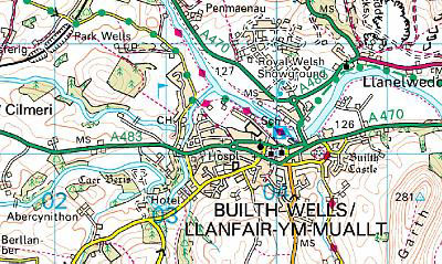
Image produced
from the Ordnance Survey Get-a-map service.
Image reproduced with kind permission of Ordnance Survey and Ordnance Survey of Northern
Ireland.
Further east from the village of
Llanelwedd another industrial estate has been constructed on an
area of the old quarry. Trees and bushes have been very
successfully planted here, providing not only screening but food
and cover for several species of birds. It is also an entry point
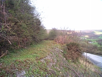
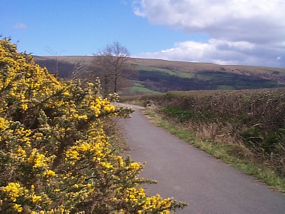
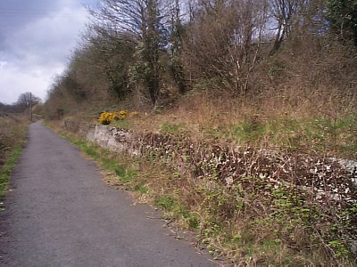
for the cycle track (part of the National Cycle Track scheme),
which provides a very pleasant walk alongside the river Wye.
Although not a long walk, it is possible to see swans, geese,
ducks, rabbits, buzzards, and smaller birds, plus the heron. The
track is constructed on parts of the old railway line, so has a
good range of established trees and bushes. The fox can often be
traced by his distinctive odour. Even the red kite flies over the
town on occasions, mobbed by crows, rooks or jackdaws, sometimes
escorted by the buzzards whose territory the kite is passing
through. The kite is probably from a nest on the nearby Aberedw
hills, but the largest population is around Rhayader and the Elan
Valley. The track passes behind St. Matthews Church, the parish
church of Llanelwedd, on a slight rise positioned between the
river Wye and the A483.
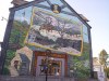
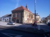
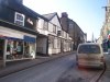
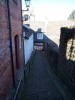
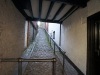
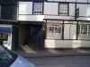
Photographs below from left to bottom right: Llanelwedd church viewed from the Cycle track; The Wye upstream from the Wye Bridge; The Llywelyn mural, end of Broad Street; The Wyeside arts centre; Looking west on High Street; Looking down Cobble Lane from Bank Square; Looking up Cobble lane; The former Drovers Arms, now a tea room; The town of Builth from Garth Hill
Off road cycling has expanded in the area, and the White House Farm campsite is home for hundreds of riders over a weekend for the Merida race. Walkers will find the Wye Valley Walk, one of the long distance walks of Wales, as well as numerous shorter walks throughout the area.
Reference sources: A Pictorial Guide to Builth Wells (Malcolm Morrison, 1989); Towns and Villages of Wales: Builth Wells (Sinclair and Fenn, 1993);
Home | The Town | Castle Intro | Castle | Llywelyn | Links
All photogaphs and content copyright © 2005 P. Jones